Sources
Autonyms with sources
- Google Sheets spreadsheet of possible autonyms (endonyms/self-names), with source websites and publications.
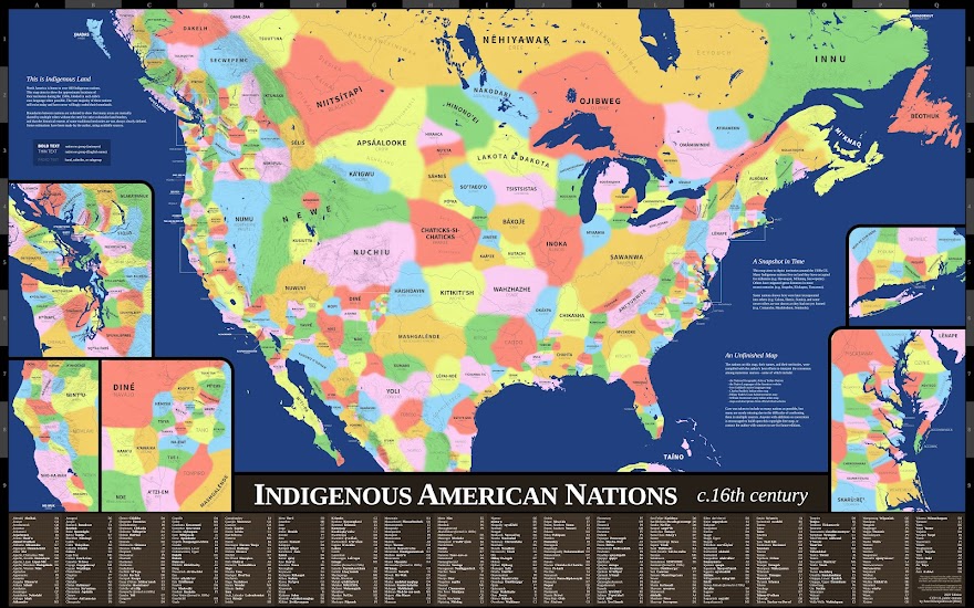
Selection of maps consulted
Many maps and written descriptions of traditional territories were used to locate each nation's approximate location on the map, using my best attempt to interpret their general consensus. This is a selection of some of the maps that were consulted the most.
- Goddard, Ives. "Native Languages and Language Families of North America." Smithsonian Institution, 1999.
- Hlady, Walter. “Indian Migrations in Manitoba and the West.” Transactions of the Manitoba Historical Society, ser. 3, no. 17, 1961, pp. 24–53.
- Native Languages of the Americas, www.native-languages.org.
- Paullin, Charles, and John Wright. "Indian Tribes and Linguistic Stocks, 1650." Atlas of the Historical Geography of the United States, Carnegie Institution of Washington, 1932, plate 33.
- Rudd, Hillary, and Brian Thom. "Coast Salish Territories." Coast Salish Senses of Place, McGill University, 2005, p. 61.
- Sturtevant, William. "Early Indian Tribes, Culture Areas, and Linguistic Stocks." Smithsonian Institution, 1967.
- Treuer, Anton. Atlas of Indian Nations. National Geographic, 2014.