Indigenous American Nations, c.16th Century (1st edition)
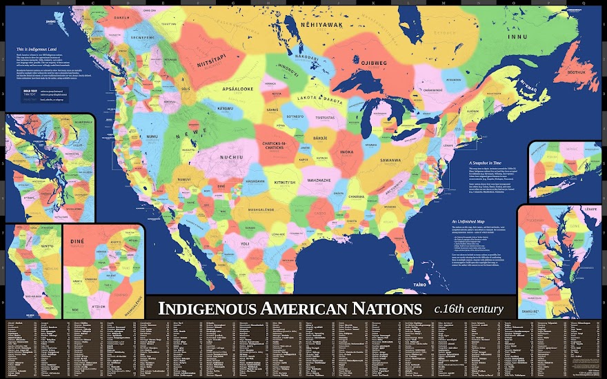
This map aims to show the approximate locations of the Indigenous nations of middle North America around the 1500s CE, labeled in each tribe's own language when available. Care was taken to include as many nations as possible, but many are surely missing due to the difficulty of confirming them in multiple sources. Anyone with additions or corrections is encouraged to build upon this copyright-free map, or contact me with sources I can use in future editions.
I've been working on this map since 2019, using as many reliable-appearing sources as I could find and freely access. There are other great maps out there that depict similar information, but not in this particular way that I had imagined. Despite my lack of any professional training in cartography, history, or anthropology, I wanted a map like this to exist, so I set out to make it to the best of my ability.
But those with proper training, and more Indigenous knowledge, would make this kind of map even better. I therefore release this map into the public domain, and all shapes and geometry that I would otherwise own the copyright to. My hope is that someone out there with more expertise in mapmaking and historical knowledge will be able to improve upon it in accuracy and completeness.
Peter Klumpenhower
Diné (Navajo)
