Other Links
Maps
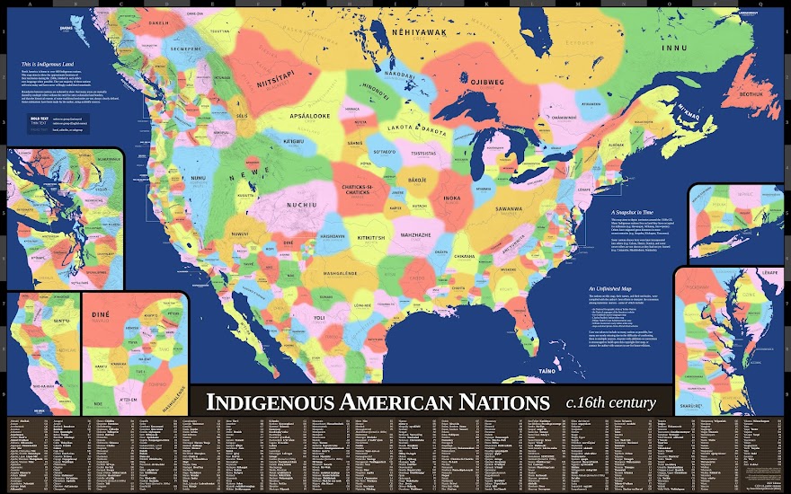
Here is a selection of other well-made maps of Indigenous land around the web that I highly recommend checking out.
- Native-Land.ca by Native Land Digital. Detailed interactive map showing traditional territories on six continents, continuously updated. One of the best maps out there for depicting how multiple nations' territories have often overlapped.
- Map of Indigenous Australia by AIATSIS. High-definition map of Aboriginal Australian and Torres Strait Islander groups created in 1996. One of the main inspirations for my own map. Printed maps available for purchase.
- First Peoples' Map of B.C. by the First Peoples' Cultural Council. Interactive map showing the Indigenous nations and languages of British Columbia. Printed maps available for purchase.
- Invasion of America by Claudio Saunt. Interactive map showing the history of land theft in the United States from 1776 to 1887.
- Tribal Nations Maps by Aaron Carapella. Many continent-wide and regional maps highlighting Indigenous autonyms in North, Central, and South America. Printed maps available for purchase.
Donate
My map is free for all to use and build on, but for those wanting to give something in return, I'd recommend any of these organizations that promote and defend the rights of Indigenous people.