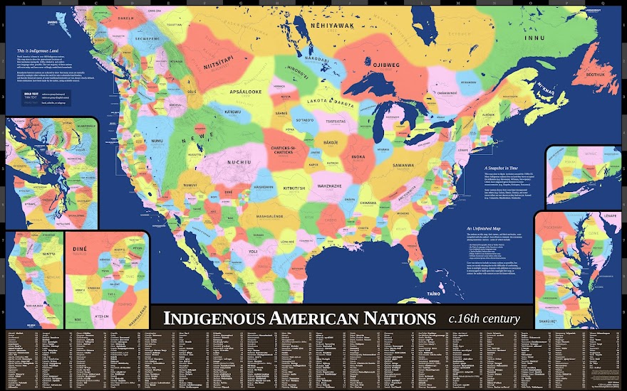
Indigenous American Nations, c.16th Century (2nd edition)
This is the second edition of my map of the approximate locations of Indigenous nations' territories around the 1500s CE, labeled in each tribe's own language when available. Anyone with corrections is encouraged to build upon this copyright-free map, or contact me with sources I can use in future editions. Some changes in this 2nd edition include: Added Clatsop, Kathlamet, Nehalem, Wahkiakum, and Willapa nations. They were mistakenly included in Chinook territory in the 1st edition. Added the chiefdoms of Cofitachequi and Coosa in the southeast. Combined Crow and Hidatsa territories. Sources indicate they separated after the 1500s. Moved Ofo territory north. Sources indicate that in the 1500s, they had not yet moved as far south as shown in the 1st edition. Reduced Cree territory. Sources indicate that in the 1500s, they had not yet entered the Alberta area. Reduced Pisacataway territory. Sources indicate that in the 1500s, they were not as far north as depicted in the 1st e...